EU project

Supporting Transparent Land Governance in Ukraine
Project Description
The Programme is providing support to the Government of Ukraine aiming at establishment of preconditions for transparent functioning of agricultural land markets, improving efficiency of land use and establishing the foundations for investments and job creation in the rural sector.
Specific Objective
Transparency of data
Land Governance Monitoring: Data collection in oblasts and rayons – Software development for automated data collection – Establishing a specialized portal for public access to data
Economic analysis: Supporting development and implementation of major steps of land reform – Modelling economic results of various scenarios of land reform launch and implementation – Promoting evidence-based political dialogue
Complete and accurate data in the Land Cadastre and Registry of Rights
Supporting error correction in the Cadastre: Digitization of privatization plans – Completing cadastral data with historical records – Developing a methodology for system error correction – Propositions for improving error correction procedures.
Supporting registration of state and communal land
Supporting registration of administrative boundaries
Efficient land governance
Analysis of actual land use: Remote agricultural land sensing (satellite monitoring): actual use data across Ukraine – Designing and establishing a geoportal for data public access – Developing a methodology for efficient land governance (in amalgamated territorial communities)
Access to legal aid for landowners and land users: SMS-alert system to inform owners on parcel data modifications – Capacity building of free legal aid provision
Supporting amendments to legislative and regulatory basis for land governance: simplifying registration and other land governance procedures to reduce related costs and time
Expected Results
1. Transparency of land data enables public monitoring which prevents communities and the state from corrupted land management and private landowners from raider attacks.
2. Complete and accurate land registration helps to be informed on what and how much land is owned by the state/ communities/ citizens; protect property rights to land; prevent conflicts between private landowners and land tenants in communities (for instance, caused by overlaps in the StateGeoCadastre); accelerate establishing small and medium farms as an essential pre-condition of agri-sector crediting by banks; simplify access of agri-producers to finance and stimulate generation of added value; create new job places and raise living standards in rural areas; increase the potential land value when land market is opened.
3. Analysis of actual land use helps to determine the efficiency and productivity of land use, land use beneficiaries, and environmental impact of land use. It also allows each community to increase the economic returns on using its land.
4. Simplification of land procedures decreases corruption and catalyzes land-related business activity. Public access to legal aid and using digital capabilities for error detection and notification of landowners on registry data modifications helps to reduce the risks of abusive and illegal land operations.
Beneficiaries

Lviv International Workshop «Strengthening Land Governance for Growth in Ukraine»

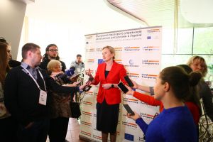
Panel Discussion “Effective management of land resources” in the in the framework of XIXth Lviv International Economic Forum “Invest in Lviv Region”
Project map
Photo gallery
Panel Discussion “Effective management of land resources” in the in the framework of XIXth Lviv International Economic Forum “Invest in Lviv Region”
Lviv International Workshop «Strengthening Land Governance for Growth in Ukraine»
PROJECT DETAILS
Ukraine
Priority Area:
Partnership that creates Subsector:
Agriculture and rural development Topic:
Agriculture Project Status:
Ongoing Start Date:
22.12.2017 End Date:
30.04.2026 Website:
https://ukraine-landpolicy.com/
EU Project Number:
387-093, 418-654 


